USP campus displayed in Google Maps
You can navigate using the Google map window at the right of this text
or
To see a Google map with indications of the event locations (auditorium, restaurant, taxi stops, banks & money exchange, etc.), follow this link.
To see the location in Open Street Map, follow this link.
Geo-referenced coordinates and GPS data can be found following this link.
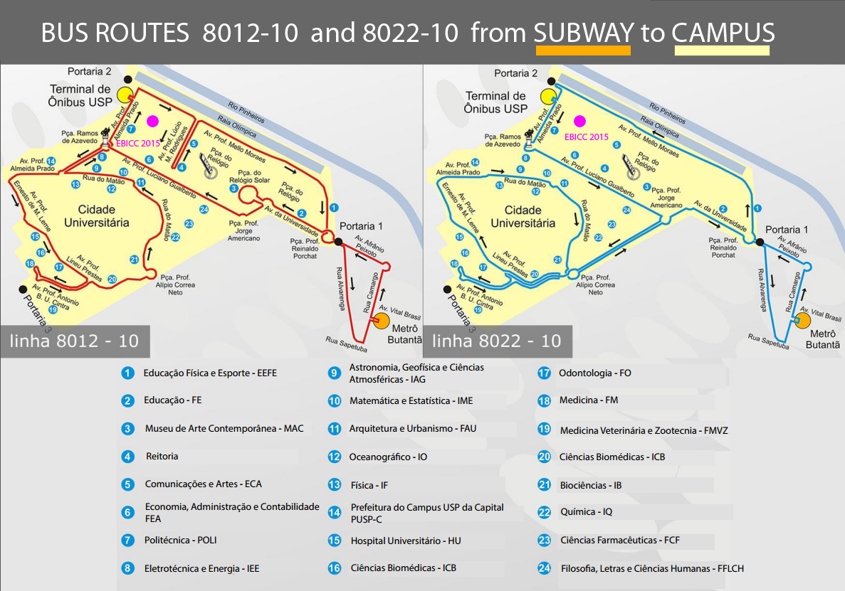
Bus routes
Routes of the lines 8012-10 and 8022-20. Both lines start and end at the BUTANTA subway staion (located outside the campus) and cross the whole campus following different paths (red and blue in the maps).
You can click in the map at the right of this window in order to display it in a separate higher resolution browser window
or
You can download it
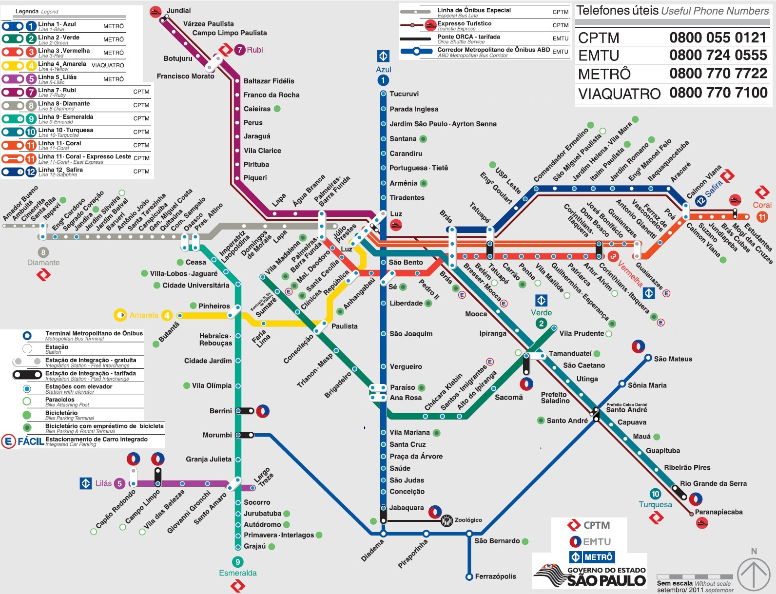
Subway (METRO) & Rail
To get to USP via subway you must reach BUTANTÃ subway station via Line 4 (Yellow) and take the bus (see above). Alternatively, go by train to station CIDADE UNIVERSITÁRIA and walk to the campus, crossing the bridge over the Pinheiros river.
You can click in the map at the right of this window in order to display it in a separate higher resolution browser window
or
You can download it
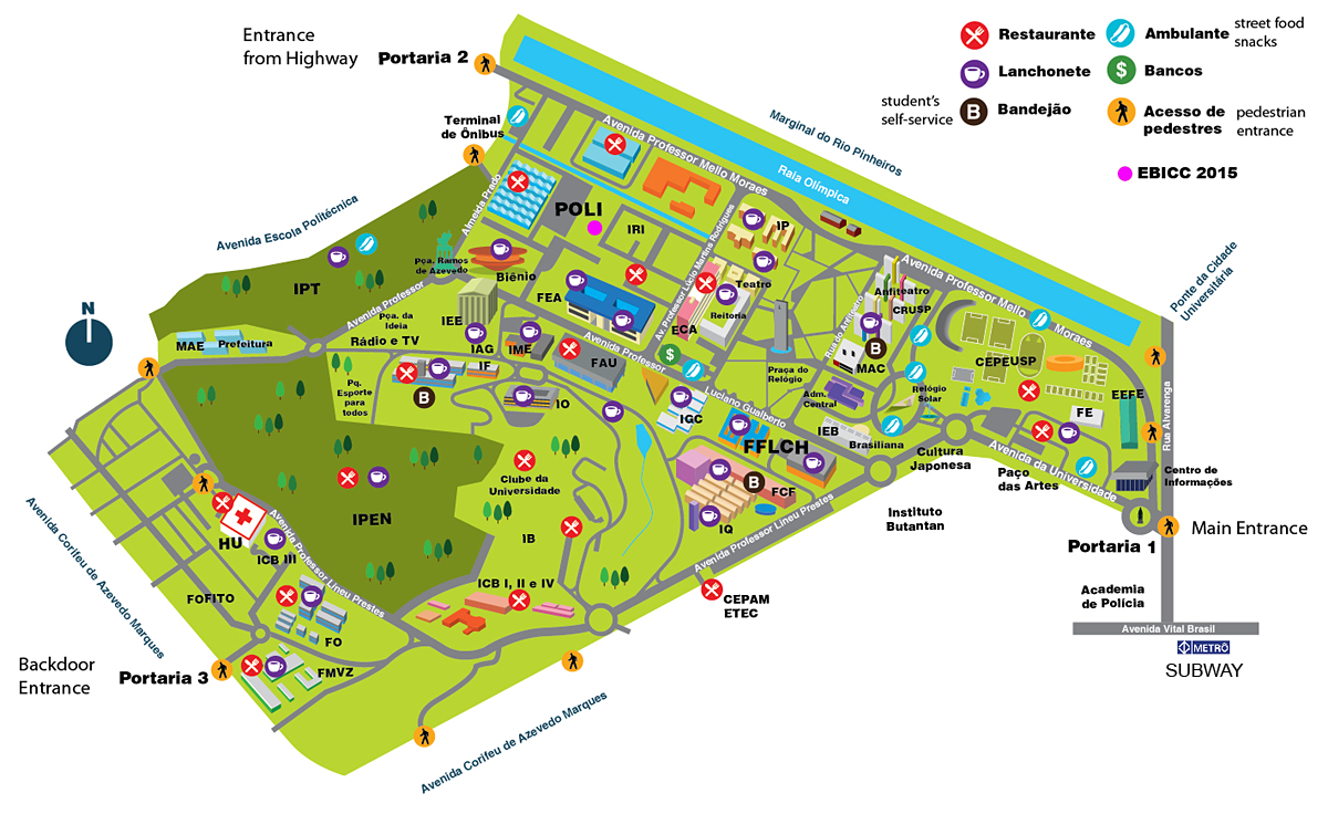
Campus facilities
All restaurants, cafeterias, street food vendors, banking sites, taxi stops, and entrances.
You can click in the map at the right of this window in order to display it in a separate higher resolution browser window
or
You can download it
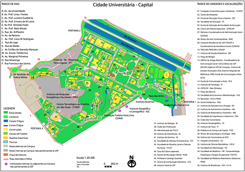
Campus buildings
Complete campus map
You can click in the map at the right of this window in order to display it in a separate higher resolution browser window
or
You can download it
- PDF (892 KB)
- High resolution campus and neighborhood map - PNG (16 MB) 6224 x 3872
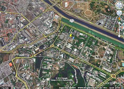
EBICC 2015 spot on Google Earth
Click on the image at the right
or
download the .kmz file
- KMZ(1 KB)
(You must have the Google Earth application installed)
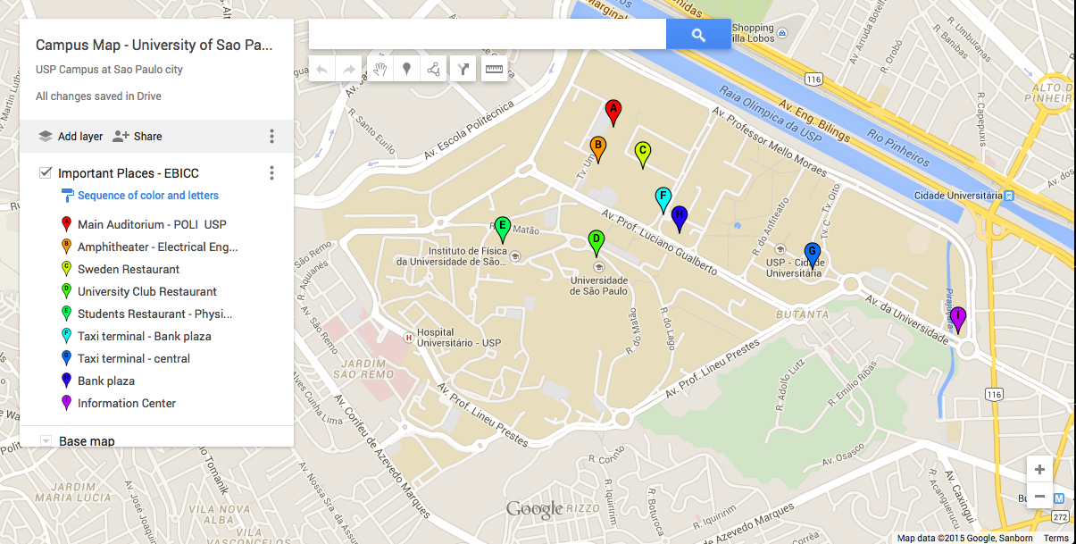
EBICC 2015 landmarks
Locations related to EBICC-2015
You can click in the map at the right of this window in order to display it in a separate higher resolution browser window
or
You can download it
High resolution map of the EBICC-2015 spots: PNG
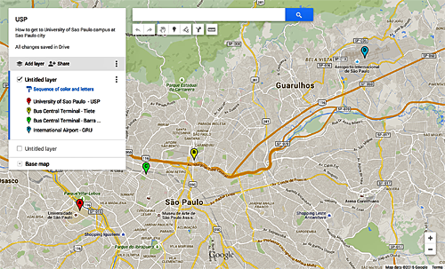
Getting to São Paulo
By plane or by bus - indicationsof the Guarulhos International Airport (GRU) and the two Bus Terminal Stations (Tiete and Barra Funda)
You can click in the map at the right of this window in order to display it in Google Maps navigator in a new window of your internet browser
or
You can download it
Getting by Bike
You can navigate using the google map window at the righ of this text.
To see the map legend click in the upper left square
The map display the bike paths (ciclovias) currently available, surveyed by vadebike.org